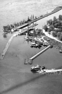
I get lots of questions on the details of the exit plan, from the time that you arrive at the third crib at the end of the Hydroelectric Plant route (or you make your way to that spot from any of the other routes). Most times, divers have a general knowledge of the territory but have trouble remembering which crib is which.
Key Points:
- From the cribs to the beach, you’re in a zone of essentially NO current, certainly at this time of the season. If you set your compass for a definite heading and then carefully follow it, you’ll arrive at your destination just about bang on. The more you do it, the more comfortable you’ll be with arriving a few feet to either side.
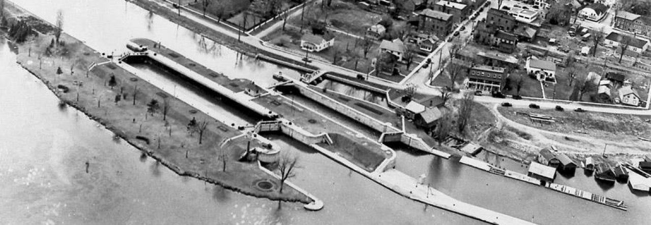
- The following structures are all cribs (wooden beams joined into a block that’s filled with round boulders):
- (a) “1”, “2”, and “3”, dilapidated square cribs at the end of the HE Plant tailrace, which probably supported various loading docks;
- (b) the “municipal wharf”, which is constructed the same way but is larger and lower; and
- (c) the “ferry dock” which is very large and made of unsawed logs.
Here’s a diagram of the route in its most simplistic form. I pore into the details in this post but here I’m going to stick with the basics. It should be evident on a tablet or computer that you read the directions from the bottom up, but I suspect they won’t be displayed alongside the diagram this way if you are viewing on a phone.

From the stump, head straight N -you’ll arrive right under the floating docks of the beach.
Follow the mid-water line along the side of the road up to the stump. The line is attached to all the posts. The stump is the best spot to deploy your SMB.
Head NE to the Ferry Dock.
Follow the low-lying line on the west side up to the concrete slab which is only a short distance away.
Head NE to the Municipal Wharf.
Follow the line to the point at which it turns.
Find the line at the end of Crib 3. It’s low to the ground and attached just beyond the NE corner of the crib.
Find Crib 3. Crib 1 is in terrible shape. Crib 2 has a partly buried pipe on its north side. Crib 3 has a yellow DOMINION sign on its north side.
Once you get accustomed to this route, you’ll wonder how you ever had problems. Then you can play around with following and exploring the “berm” of the old village. This is generally at the level of the stump (currently about 11 feet) and the start of the weeds. You can follow it using depth as your gauge, all the way back to the Hydroelectric Plant.
As always, contact me if you have any questions or comments.
sydneyschnurr@gmail.com
Sydney
