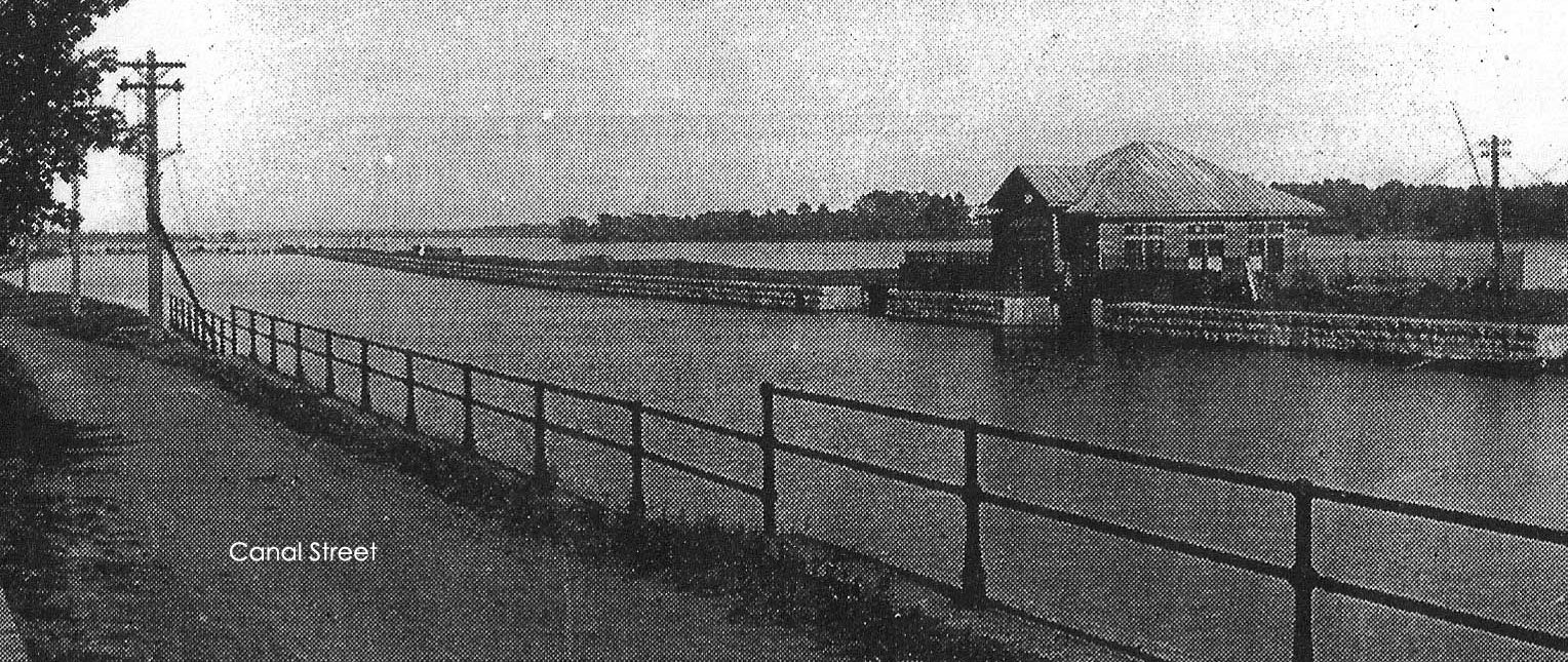
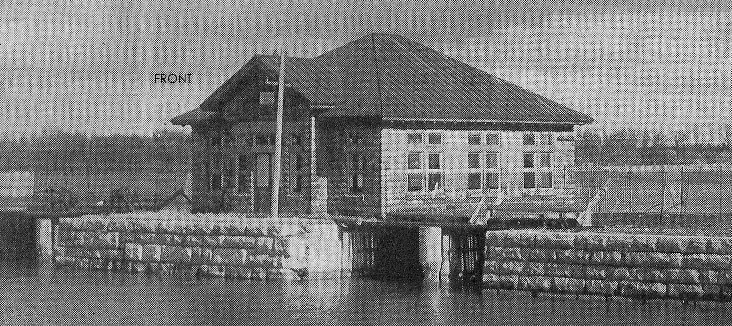
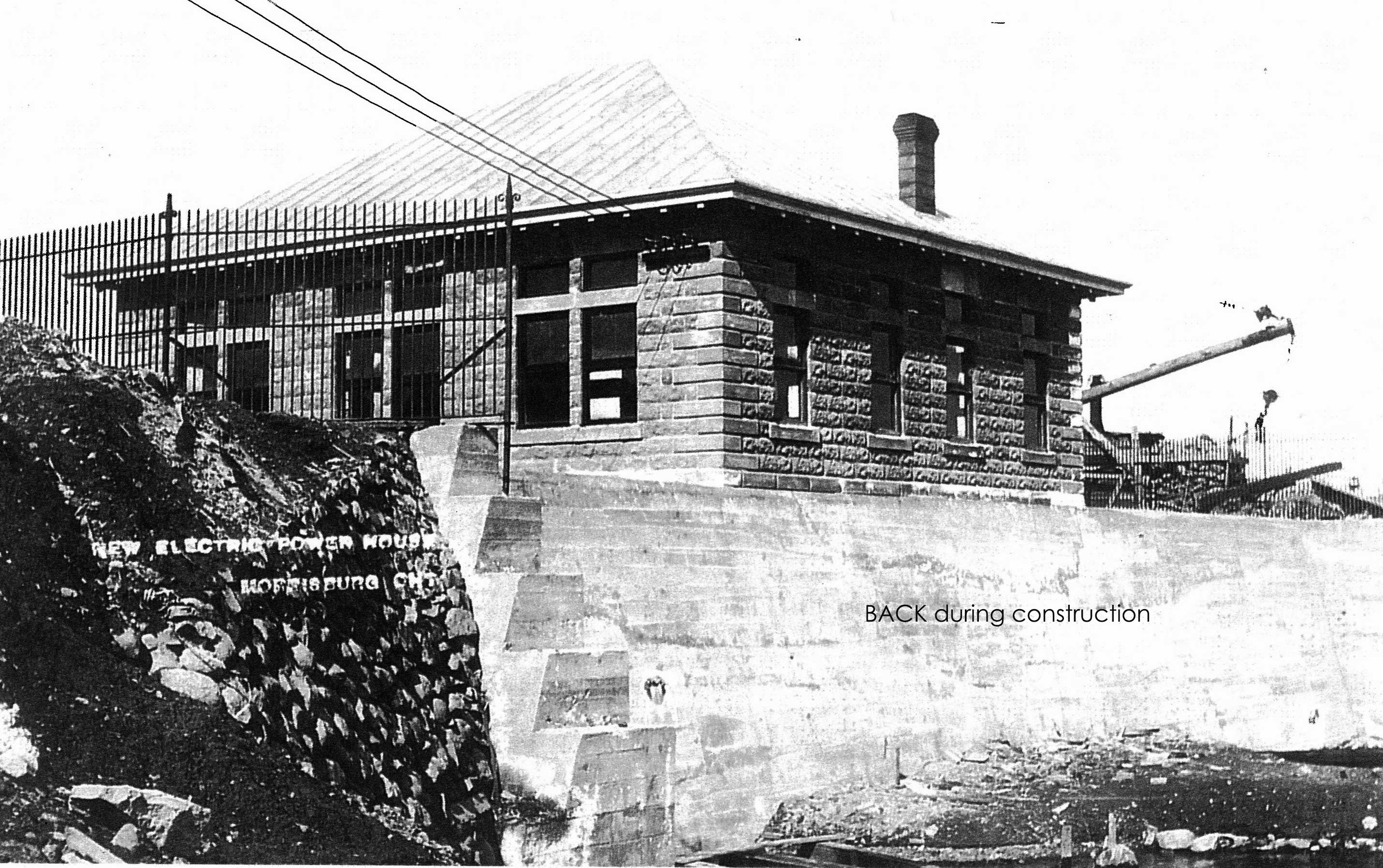
The Canada Tin Plate and Sheet Metal Company Power House
… known as “The Tin Plate” to us …
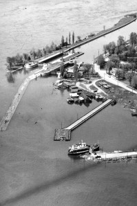
Housed in an enormous building at the far eastern edge of town, the Canada Tin Plate and Sheet Metal Company was the only mill of its kind in the Dominion of Canada when it was built in 1907 (sadly, no photos are available). The Morrisburg Village Council assisted with its start-up by constructing an electrical power plant for its sole use on the south berm of the Rapide Plat Canal, including power lines to the factory, all excavations and machinery, and 1100 horse-power. The factory was expected to lease the premises and purchase the power.
From the outset, the Power House had difficulty maintaining the level of power needed by the factory and there were frequent power shortages. In addition, during operation there were often surges of water in the canal that slammed boats into the canal sides, particularly when travelling downstream.
Even though markets were available, the frequent power shortages plus poor financial management led to the plant shutting down in 1912 with final demolition in 1917. Its power house was not used again.
Preparing to Dive
Plan on a 30 to 45-minute dive. Maximum depth is about 35 feet with several ups-and-downs to as shallow as 10 feet due to low river levels at this time (2021).
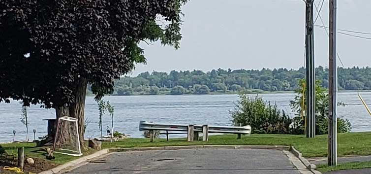
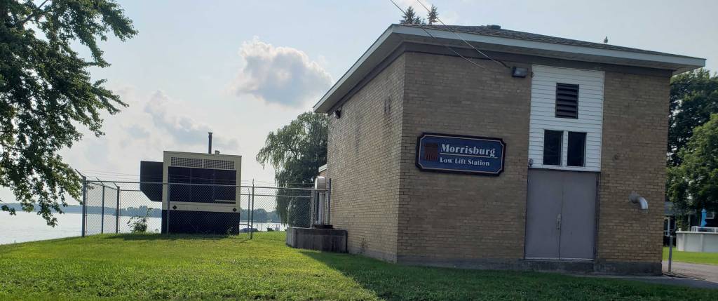
The dive site begins at the end of Augusta Street, one (lengthy) block west of the Public Boat Dock. Exit is at the public dock. Augusta is a short, quiet residential street with the town’s Low Lift Station at the end of the road on the west (right) side. Entry is directly in front of the road itself.
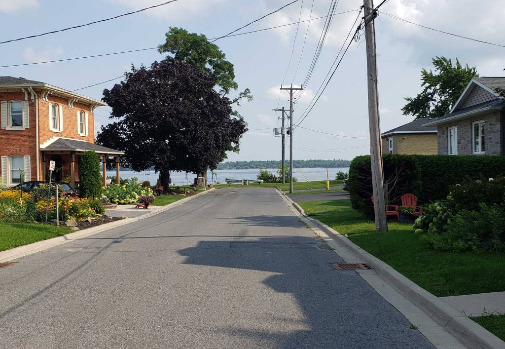
Please note that this is smack-dab in the middle of a neighbourhood with young children often outside. To enter the water, you actually encroach upon the corner of these properties, especially on the east side, and all your movements are public…. Please, please, PLEASE do not use the area as a bathroom – kindly use the one at the public boat dock before arriving here.
There is space for one or two vehicles at most to remain here during the dive. If you have a large vehicle, the most sensible option is to pile all of your group’s equipment into it and have the divers (with wetsuits on) walk to the entry. When the vehicle arrives, gear is unloaded and the vehicle is parked on Augusta during the dive.
Smaller vehicles should individually drop off gear, leave a diver or two to watch it, then return their vehicles to the public boat dock and walk back. It is, after all, only one block… and it’s really nice having your vehicle waiting for you at the exit point.
The Dive

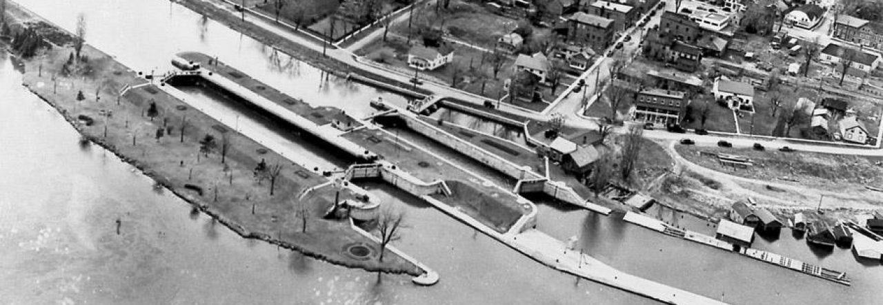
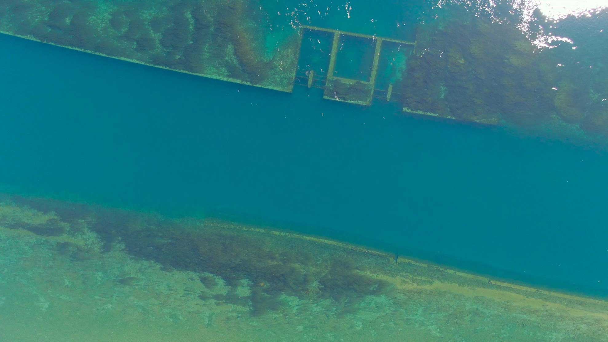
Photo is courtesy of John Gleed’s video at https://stlawrencepiks.com/lock23fromabove/index.html
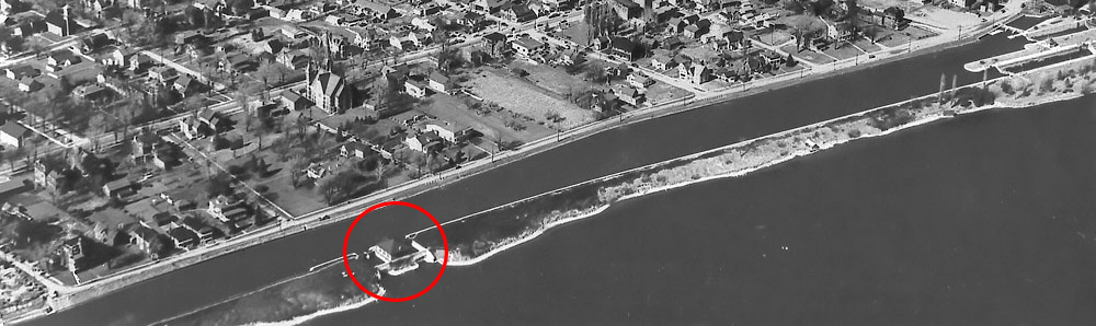
Augusta Street today is in the identical location that it was in 1959, with the land coming right up to the canal edge (you can easily see the flooded area and the borders of the canal underwater in the image above). The only difference is that it is now under an extra 15 feet of water! The Tin Plate Power House is downstream a bit from the entry point, which gives you some leeway for drifting with the current as you cross the canal.
Crossing the Canal
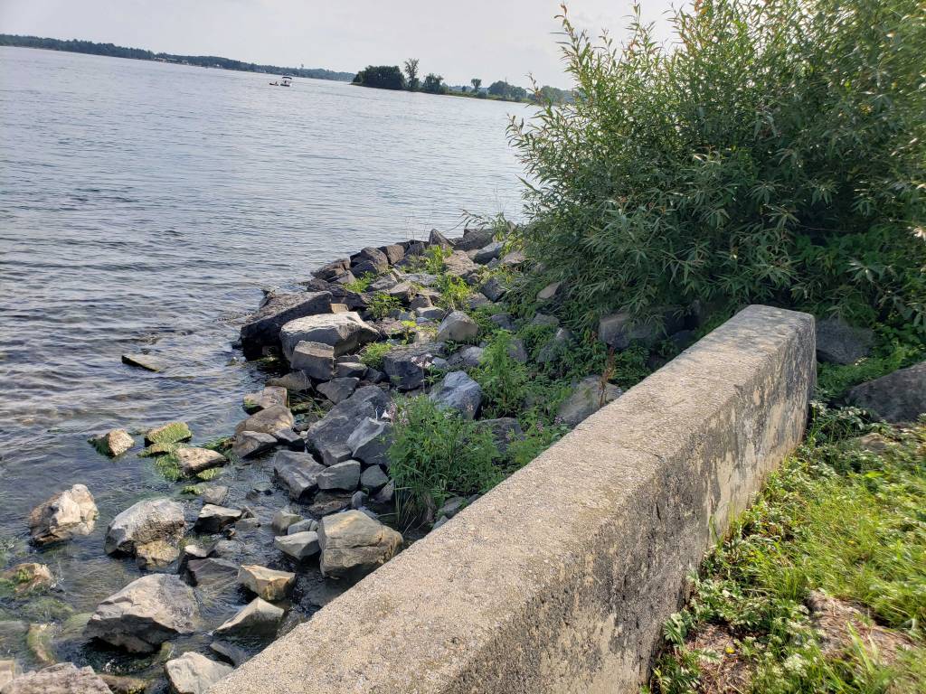
Entry is over large boulders in shallow water. It drops off fairly quickly and the canal wall is only a few feet from you. You’ll feel the current immediately so keep close to one another, remaining tightly grouped as you descend and equalize.
Once at the bottom, it’s a matter of moving south across the current to reach and climb the berm on the other side. The centre of the canal is at about 36 feet. Stay low – this is the narrowest part of the river between Montreal and Lake Ontario and, while variable these days, the bottle-necked current can be very, very swift. There is no value in proving how strong and capable you are by staying mid-water; it’s a good way to lose your buddy. Because it’s so narrow, the crossing takes only a couple of minutes.
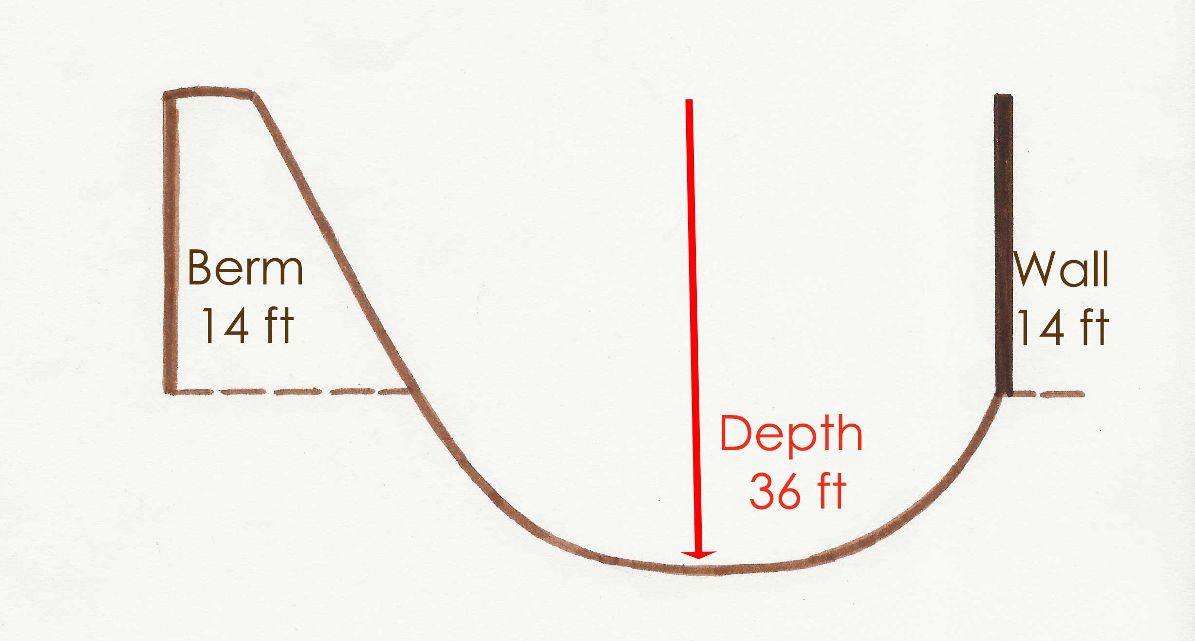
Crossing the canal sounds easy. But here’s the catch. Unlike at Lock 23, you are not approaching a “can’t-miss-it” wall. You’re approaching a berm. The territory all looks the same except for depth changes. As you cross, you must keep your eyes glued to your depth reading and your compass to south.
Many divers have arrived at the Public Boat Dock exit only to say that they missed the Tin Plate altogether. This is because they went up and over the berm, then down lower than the Tin Plate on the other side. When they turned to drift, they breezed right past it.
One of my personal slight annoyances at this spot is that it’s the only place in the river where I consistently get vertigo as I move across. I think it’s because my brain sees all the terrain as the same even though depth changes. I usually have to ask Larry to stop at the end to give my equilibrium a few moments to reset.
Once you’ve reached the berm, the weeds at the top point to the Tin Plate. While you can drift at any depth, keep above 20 feet if you want to catch the squared off start of the wall at the top of the berm – about 75 feet before the site.
You’re about to arrive at the Tin Plate… more about it in the next post.
