The Rapide Plat Canal, which fed the Rapide Plat Lock and later Lock 23, was an example of a “navigation” canal. It was built parallel to the river to create a reservoir to fill the locks and a channel for the boats to then travel upriver as they went past the Rapide Plat (“Flat Rapid”) – a table-like set of swift rapids that stretched over 4 miles (6.4km) and a 12-foot (4m) rise in the river.
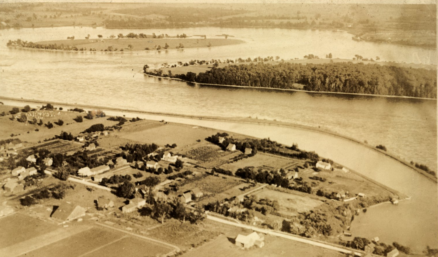
Of interest, the rapids were only on the Canadian side of an island in the middle of the river and could be safely avoided by travelling on its south side (you can see the geography in one of the photos below)… but merchants did not want to travel close to the American shore with boats filled with goods destined for upstream Canada.
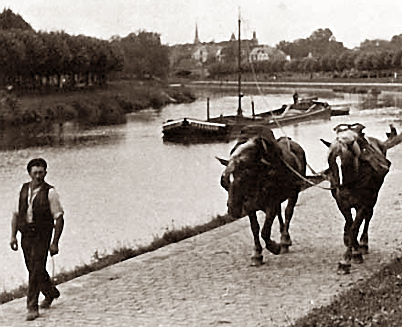
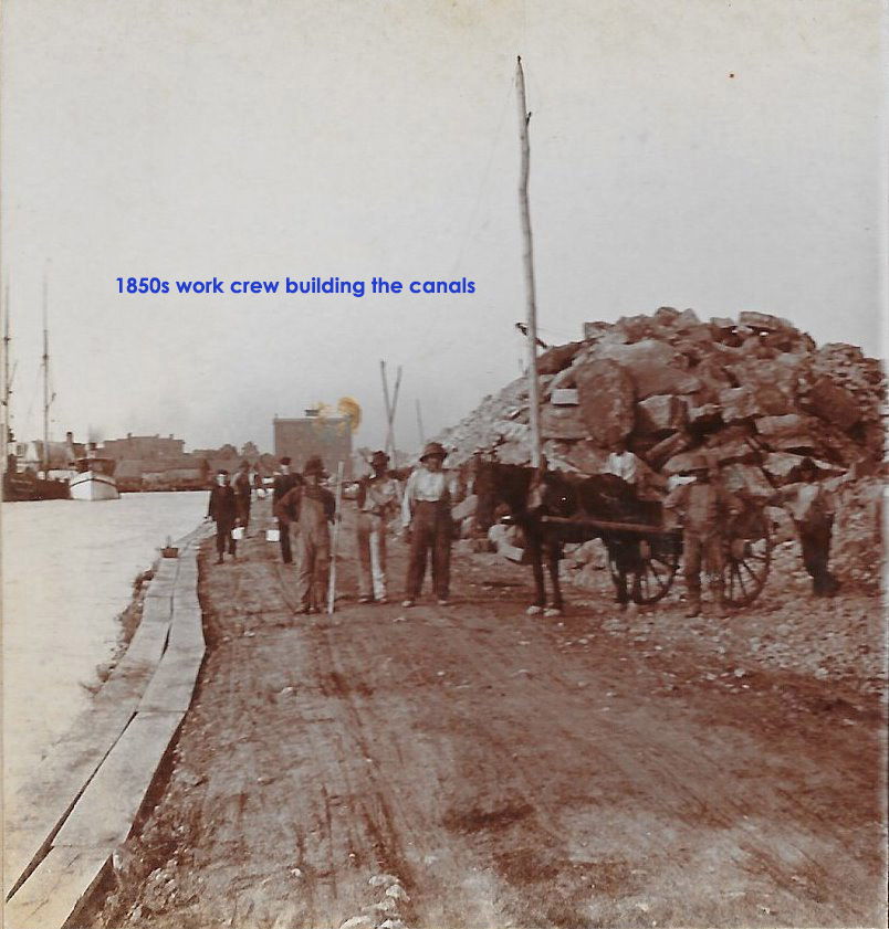
Long before the locks, the canal was a simple hand-dug channel kept separate from the river by a berm and used to pull watercraft upstream with horses on a towpath on shore.
As boats got heavier and larger, manpower wasn’t enough to pull them. A lock (basically a box with gates at either end) was constructed as a dam across the canal. To provide the extra 12-ft river rise, the Rapide Plat Canal had to extend the full 4 miles upstream.
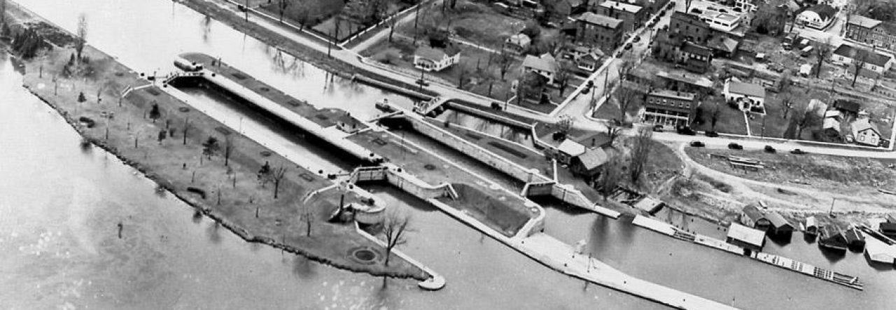
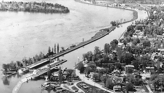
A vessel entered the open downstream gate while the upstream gate was kept closed. Once inside, the downstream gate was also closed and water let in to raise the level inside the lock to match that of the upstream canal outside. The gate opened and the vessel exited to travel along the canal until it passed the rapids and could safely move over to the river. This point was just upstream of “Guard” Lock 24 – which looked the same but with no change in water level, existing only to close and reduce flow during flood or foul weather conditions.
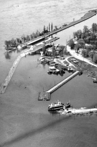
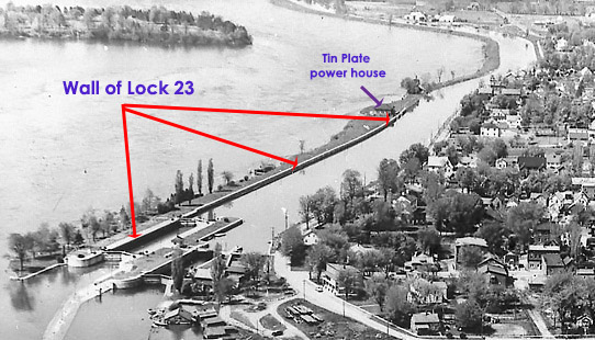
Rapide Plat and Lock 23 at the downstream end 
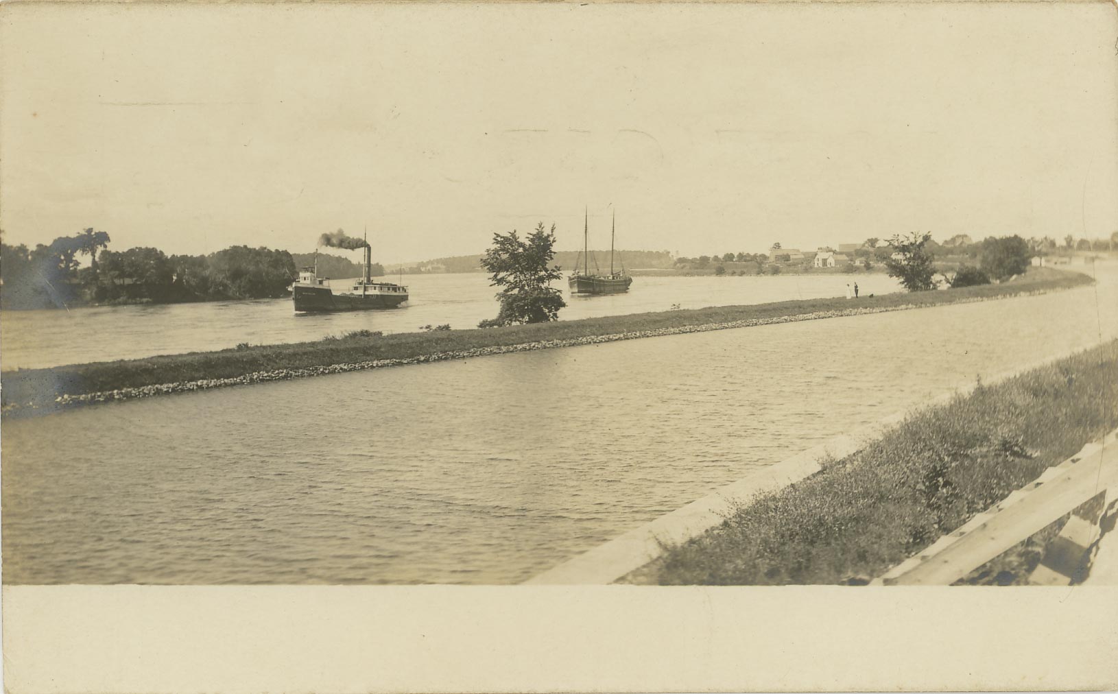
the middle section 
Guard Lock 24 at the upstream end
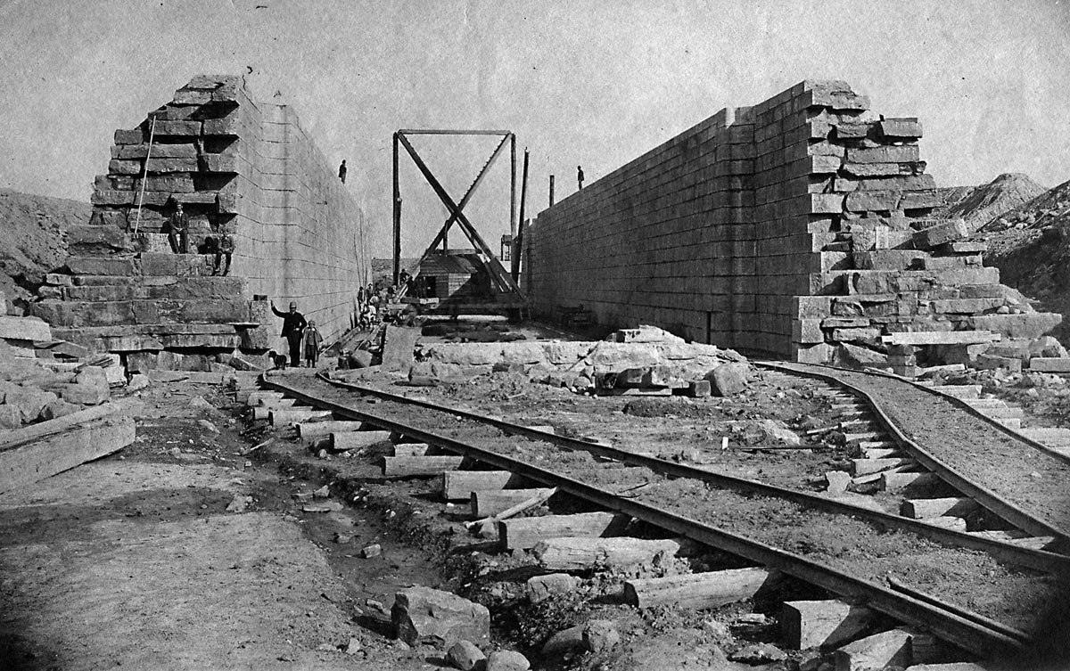
The Rapide Plat Canal walls on either side were constructed differently depending upon their location. All of those differences are still evident to the diver today.
The South Wall (River Side)
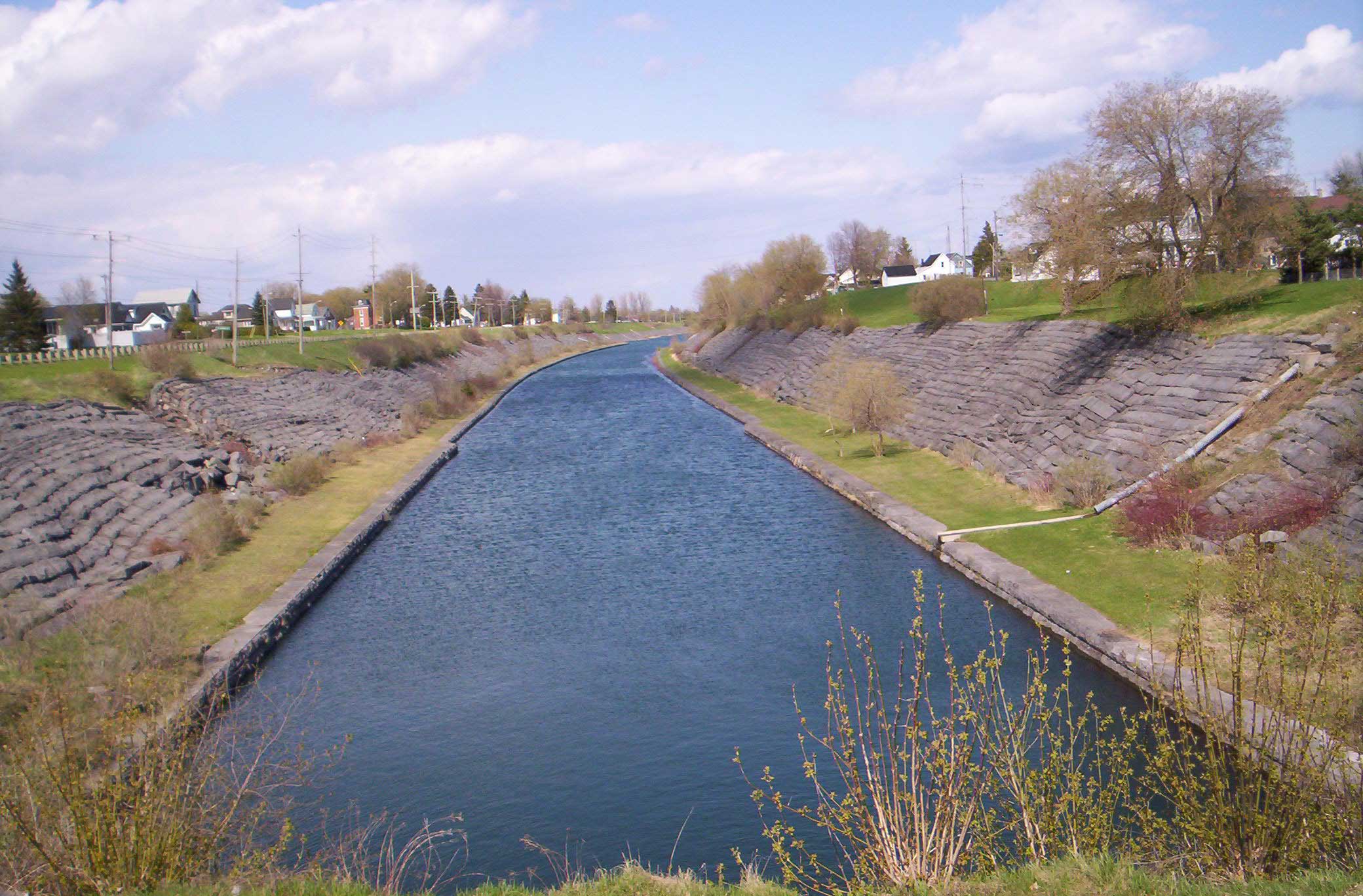
Canals built in the 1850s, including the Rapide Plat, would all have had berms as their south walls, consisting of the debris and earth removed when excavating the canal. Protection from erosion and damage was increased by the addition of stone laid on top of the earth. This was known as a “rip rap” wall.
Those old canals are all still intact and above water upstream of Iroquois… so if you drive out to Cardinal, you can view a perfect example of one.
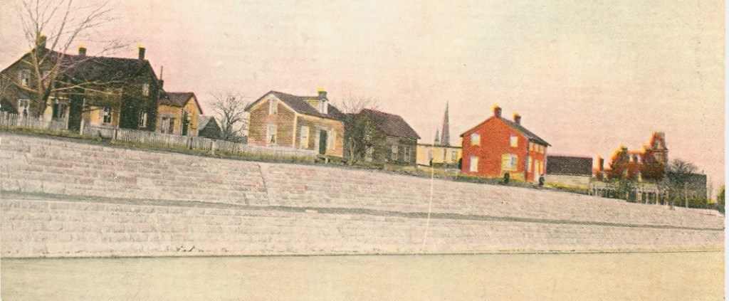
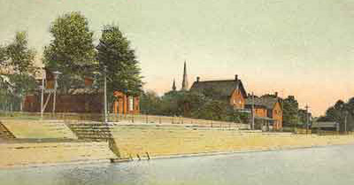
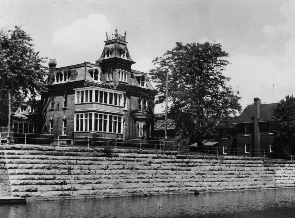
When the larger Lock 23 was constructed in 1905, its enormous south wall was extended far upstream to just beyond where you see the Tin Plate Factory Power House on the berm in this photo. The berm remains behind the wall, expanded and developed as a Park in the area of the lock itself. From the Tin Plate upstream, it continues in its original form.
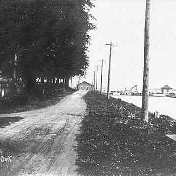
The North Wall (Shoreline Side)
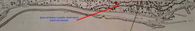
From approximately the area of today’s Public Boat Dock (where you normally enter to visit the Locks) to the locks themselves, the north shoreline wall is a sloping berm lined with stone, similar to the Cardinal canal pictured above. Here is a brief video of this from my post on drifting to the locks.
Running beside the canal, early Canal Street was a dirt road. When Lock 23 was built, the road and its accompanying sidewalk were paved so are now easily seen on dive entry at this location.

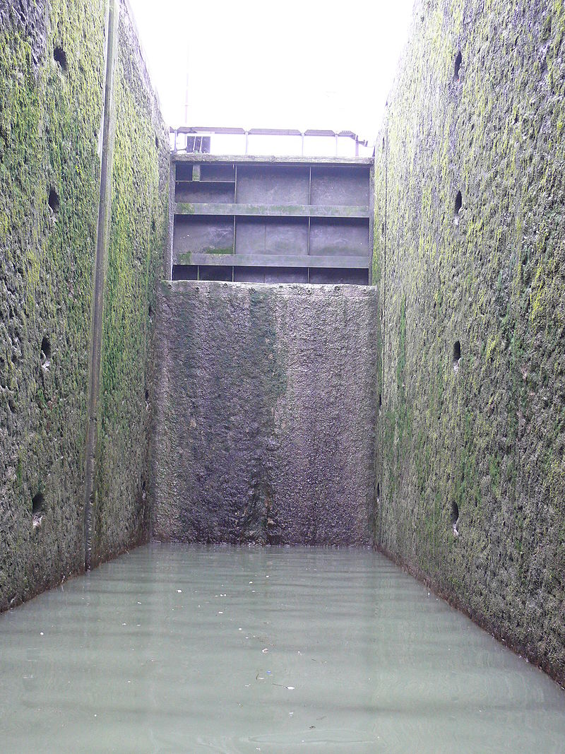
Further upstream, the north wall is built of stone blocks. On dive entry, instead of swimming down the incline of the berm, you drop to either one or two quick levels to reach the bottom of the 14-foot wall.
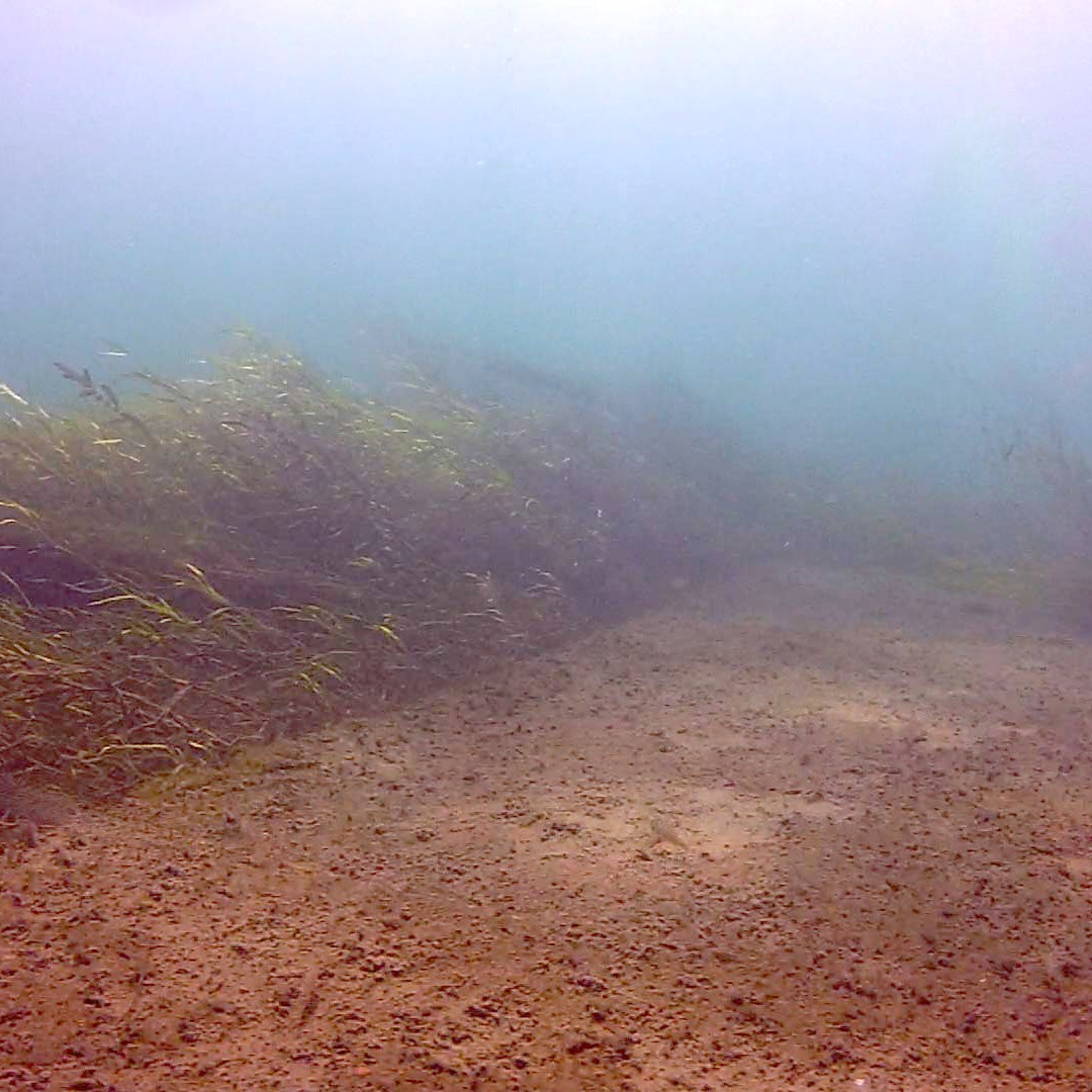
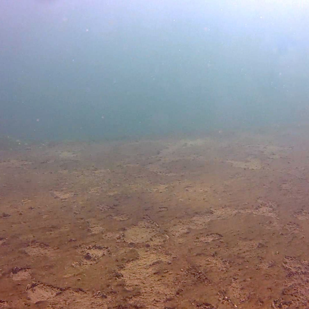
The Bottom
The bottom of the canal is simply river bottom. Pretty smooth. Pretty unremarkable. Comparatively little silt. No weeds to speak of. More clay towards the north. Wooden planks here and there. Bigger boulders as you get close to the locks. Berms of rubble right in front of the lock walls where the current is obstructed. I explain it all in this post.
The Lock 23 upstream walls were 14 feet high to accommodate the greater draught (the minimum amount of water for a boat to float without touching the bottom in either the locks or canal). When diving, as you drift through the locks, you drop the 12 feet of river depth and notice that the walls at the lower end are considerably higher.
The Seaway: Raising the River
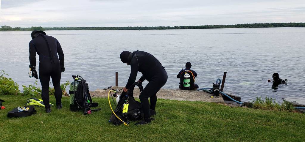
In 1959, when the Seaway was constructed, the level of the river was raised by 15 feet (5m) between Iroquois and Cornwall, safely covering the treacherous Long Sault Rapids, the Rapide Plat, and the deadly swift current near Iroquois, creating “Lake St. Lawrence”. The bottom of the 14-foot canal was now at 29 feet and the tops of its walls and berms at 15 feet. Today these depths can fluctuate by 1-2 feet depending upon river conditions upstream.
We tend to forget that this Canal was a separate entity from the river as we drift through it and move up and down and over its berms.
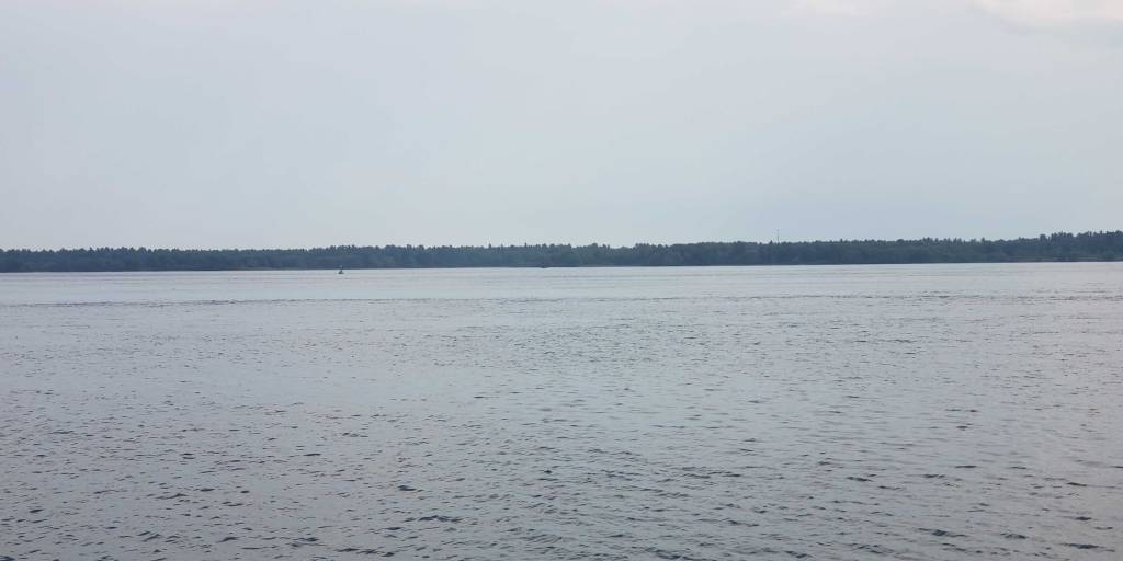
But if you look out over the river when it’s relatively calm, you can see a change in the lighting and wave action over the canal walls. Take the time to look!
Sydney
