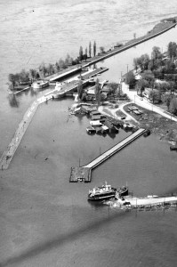
Inside the Foundation
The entrance to the Tin Plate is a simple break in the wall as you drift downstream. When you reach it, you can take your time to investigate the structure inside and out, either from the north (canal) side or the south (river) side.
All foundation walls are smooth and fully intact with smooth, debris-free tops. Note that, like everywhere else, the tops of the walls are currently (2021) a mere 10-11 feet from the surface.
Current is generally quite manageable.
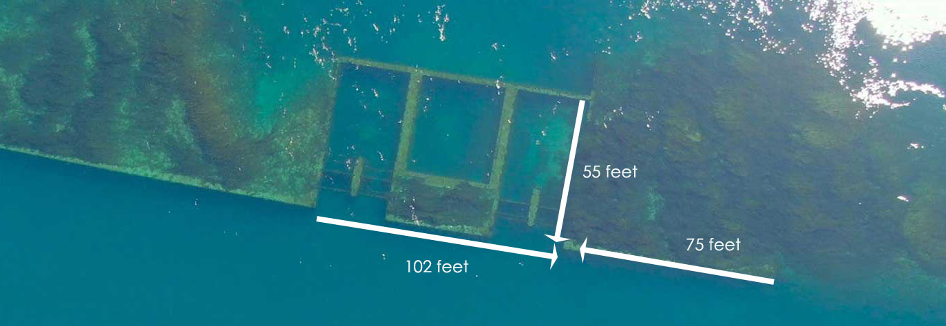
If it’s your first visit, it’s best to turn into the first opening. As you move out of the current, you’ll see concrete dividers with overhead metal bars plus a grille crossing the face of the entrance. (Interesting fact: I had to look up grille vs grill vs grate. Turns out grille and grate are interchangeable… but a grill is on a barbecue and a grille is a screen or barrier. I decided that what the Tin Plate has are “grilles”!) It’s easy to glide over all of these. Get to know the size and set-up of everything and what is within each “room”. All three have silt hills from the prevailing current and varying degrees of hydroelectric power piping. Once you are familiar with each, you can venture over the south wall and investigate the exit flow areas on the south side. Depth there is 30-35 feet.
The third, most downstream, room contains the two fully intact turbines plus a lot of additional debris and more grilles lying around.
Its exit to the canal is exactly the same as the one you came in through but has the obvious presence of two strange looking “carts” lying on their sides just outside. These were used, by way of pulley systems incorporating the overhead metal bars, to raise and lower the grilles across the intake openings.
Behind the Foundation
There are 3 ways to access the area on the channel (south) side of the foundation.
- You can drift on that side from anywhere upstream, either from your Augusta Street entry or as the second or third stop along the berm – more about that in a post to come. Keep at 20-35 feet to ensure you don’t drift right past!
- When you arrive at the entrance noted above, instead of turning in and out of the current, you can go up and travel the length of the upstream north-to-south wall. You’ll come to the stepped end of the wall where you move left.
- You can go up and over any portion of the south wall when you’re inside the foundation.
The general landscape here is mainly boulders, boulders, boulders. Their placement is more orderly near the foundation.
There is a person-sized round but closed-off entrance of some sort (I do not know what this is), near the vicinity of the third room.
Out on the ground a short distance from it is a small post with what looks like the remains of a plaque although nothing identifies it specifically. It has looked exactly the same, with no lean whatsoever, as long as I have been diving here.
As you move to the right of the round “entrance”, you will see a low metal structure. If you shine your light into it, you’ll see loads of fish. If you are trained and have the proper equipment, you can also venture inside – it leads you to the area below the turbines but there is no other exit. I have not done this myself.
At this point, most divers ascend the wall immediately above and drop into the third room. From there you leave the foundation and move across the canal to ultimately exit at the public boat dock.
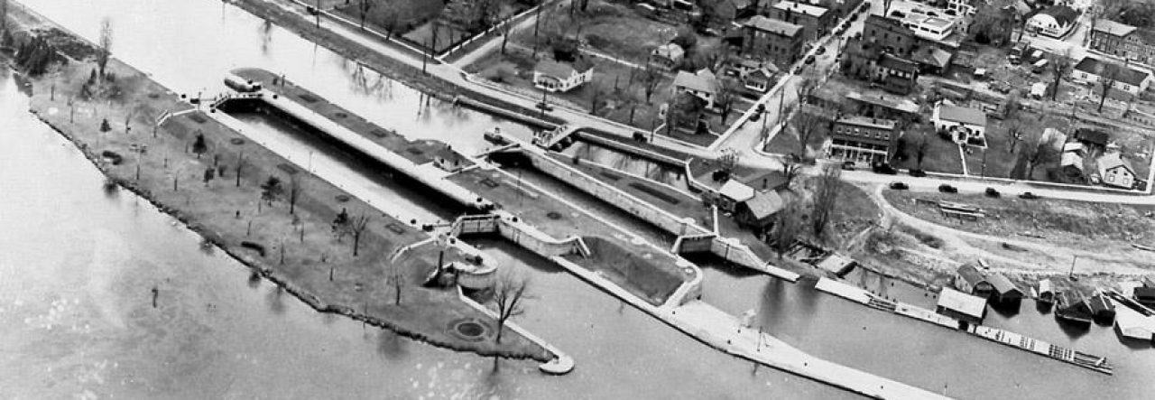
Many divers with enough air choose instead to drift all the way to Lock 23 itself, along either its great south wall or by whisking down the channel side of the berm. This will add approximately an hour to the dive.
Otherwise, you simply leave the Tin Plate and swim back across the canal… to the north berm with Canal Street at its top (the initial 14-ft wall that you descended does not exist this far downstream).
As with the initial crossing, you have some leeway for getting to the top of the berm without fear of missing your exit point (the Public Boat Dock). As you approach, the boulders are at first strewn about.
Then they become orderly.
The road should be obvious at the top, although at certain spots it is broken and weedy. Turn right!
As you skim down the road, you’ll come to this shiny white line (2022 note: it’s now a chain and even easier to see) crossing it. This is the line to our home – we live right beside the public boat dock. Feel free to follow the line to the shallows, then surface float into the public boat dock. Otherwise, a casual north-heading swim in will get you there.
The Tin Plate is a pleasant change from the longer Lock 23 drift. The crossing can have very high current but the foundation and surrounding area are generally quiet and allow for a lot of motoring around investigating things. Enjoy!
