When you arrive in Morrisburg, the shoreline and the Public Boat Launch are pretty obvious. The parking lot is right at the end of Highway 31 (called Ottawa Street in Morrisburg) – you can’t drive any farther.
Here’s a sketch of the waterfront: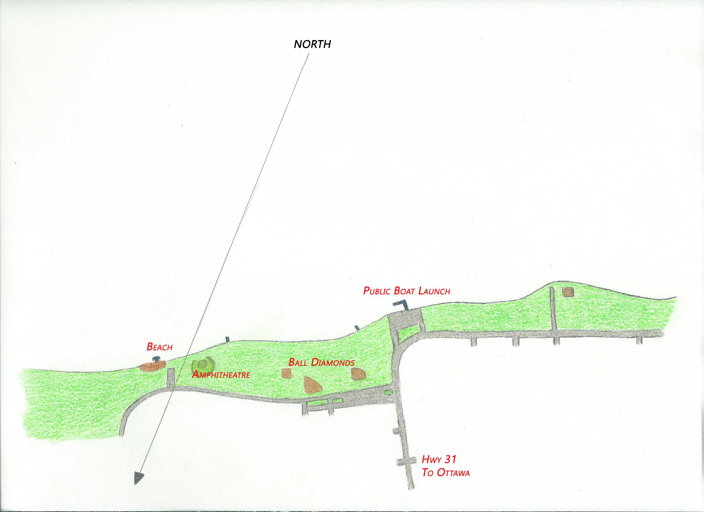
I’ve drawn the shoreline horizontally across the page, which is how you’d see it upon your arrival. In Google Earth it would be upside down to keep North at the top of the screen.
Although we think of the shoreline as East-West and Ottawa as directly North, it is not quite so. Swimming “north” at any time will get us to the Canadian shore but more downstream than we think. Add current to the mix, and it may be quite a bit more downstream.
The Public Boat Launch is the most common entry point. The Beach is the most common exit point. Note where the ball diamonds and amphitheatre are. If you must surface during the dive to get your bearings, it helps to know the park landmarks.
Here’s the same sketch but now including the dive site:
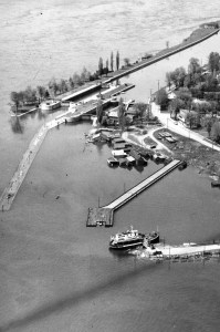
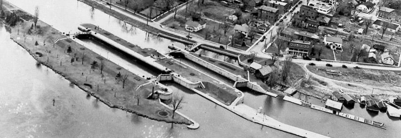
The locks themselves, though they look and feel enormous as you move through them, actually represent a fairly small portion of the village lost to Seaway flooding in 1959.
Here are the depths: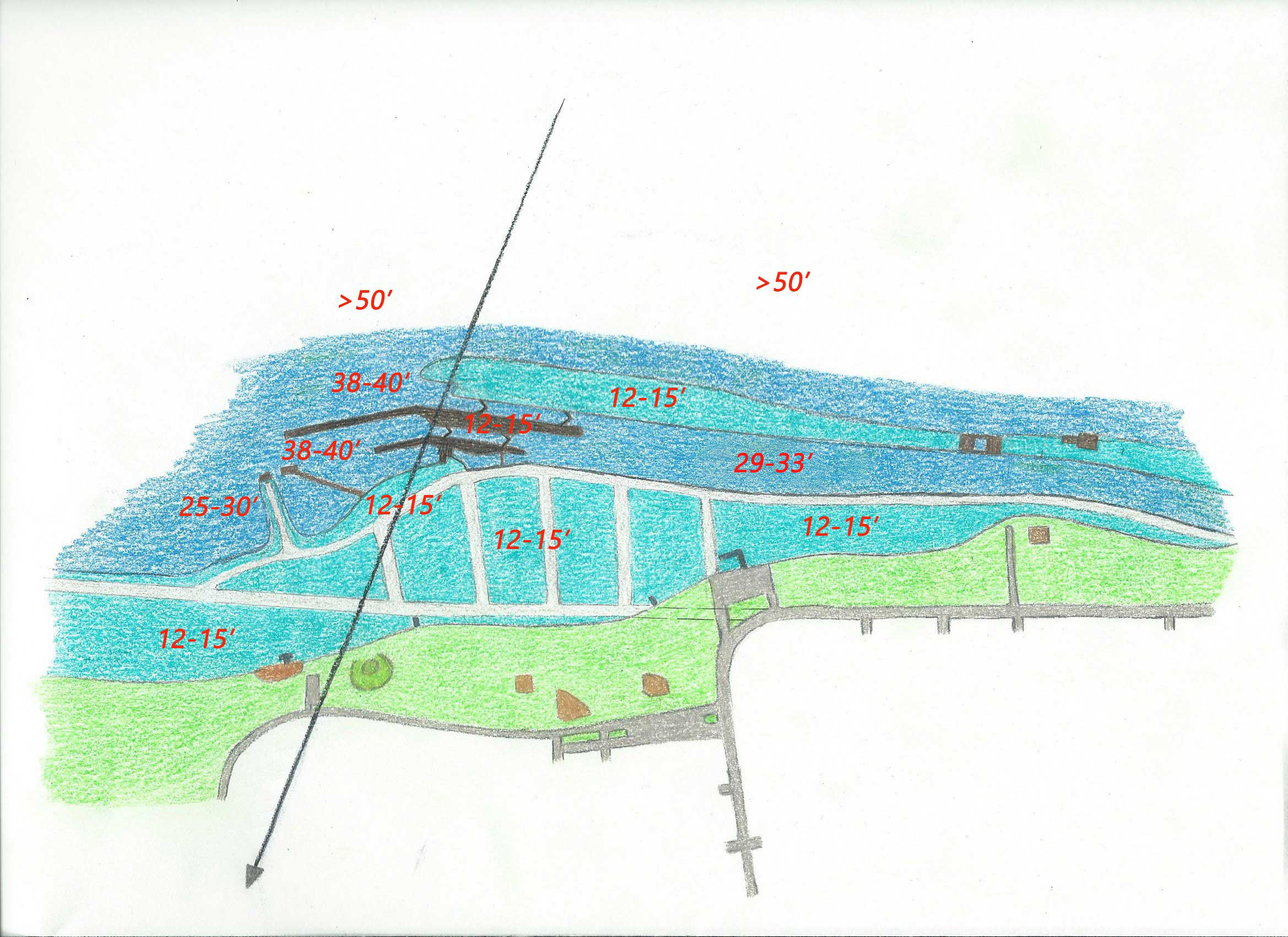
They obviously vary with seasonal changes – controlled by the Seaway dam upstream in Iroquois.
An 1880 study noted that extreme variation in river depth over 60 years was 5.5 feet, although the mean never changed. This had to be taken into account when constructing the locks. Lock 23 itself provided a rise of 12 feet.
Here are currents you’ll encounter: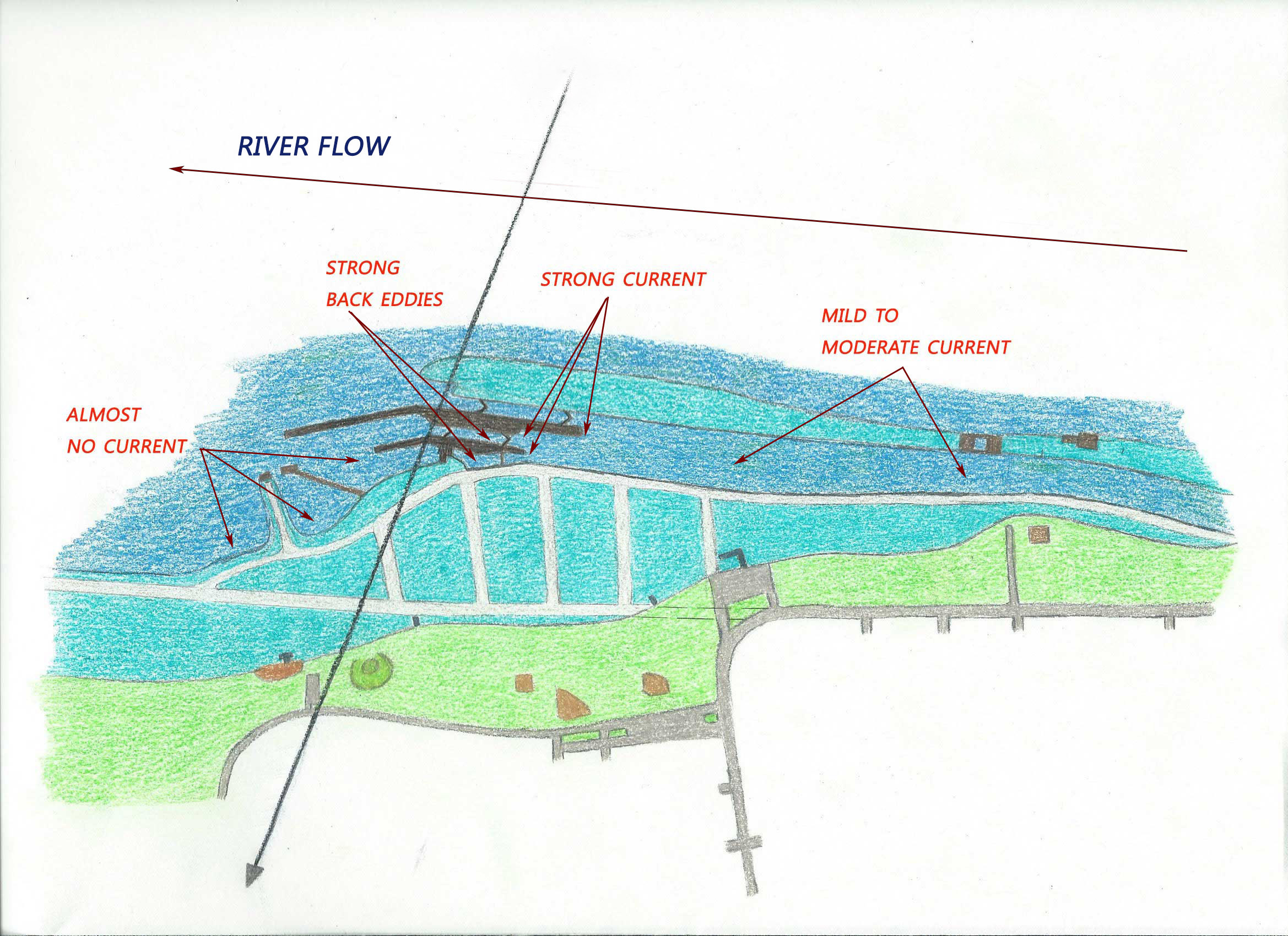
Current is strongest where the river flow is blocked by the locks. With flow reduction on the downstream side of walls and gates, back eddies can be confusing to divers who don’t expect them.
Finally, here are distances from shore throughout the dive: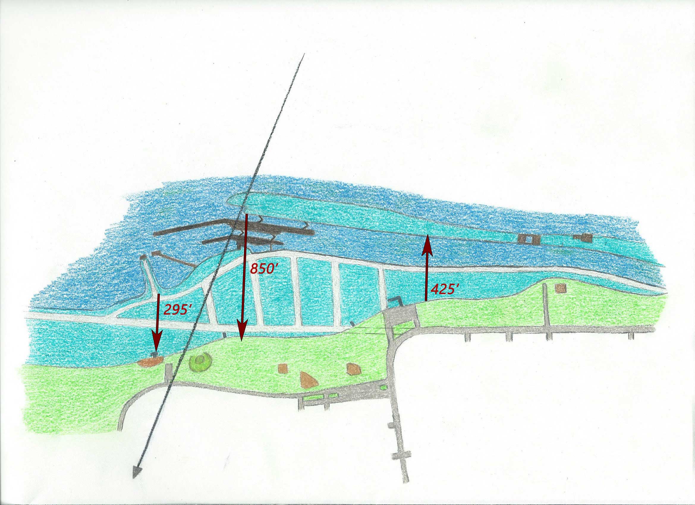
The locks are a long way out; if you swim in from the centre of them, it will be a long swim in.
Any area coloured light blue represents the original land area. All of it sits 12-15 feet below the surface and is covered in weeds making the swim (1) relatively slow and (2) close to boat traffic. It is therefore best to plan a dive route that keeps this to a minimum.
A note about weeds. Wending your way through weeds at both entry and exit is a significant part of your dive route. Almost nonexistent in the early season, they grow to a forest by the end of the summer, nearly reaching the surface. You can swim above them but this puts you very close to boat traffic (which is OK if you’re vigilant about deploying and pulling a bright surface marker). You can also swim through them; they move aside easily and they pull out easily (which means it isn’t helpful to grab them for support). They are annoying when they catch in your gear but they won’t entangle you – you just turn into Weed Man as you approach the shore!
