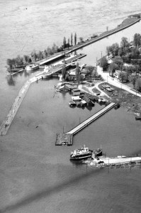
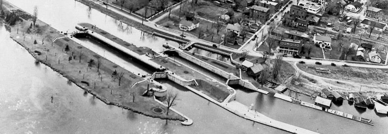
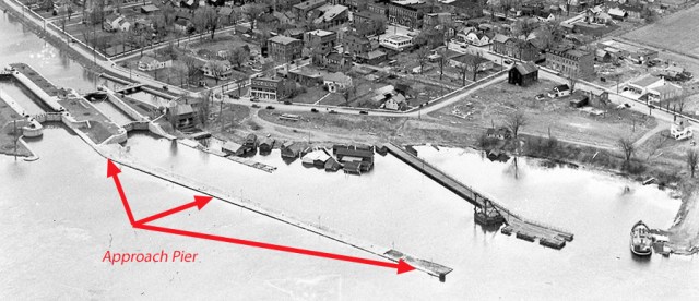
I use the word “approach drift” all the time when talking about entering and drifting to the locks. Our diving approach is obviously from upstream. The approach pier of the locks, however, is at the other end of the site – the downstream end. Ships used the pier to dock and wait their turn to enter the locks to bypass rapids or high current as they moved upstream, generally returning by way of the main channel.
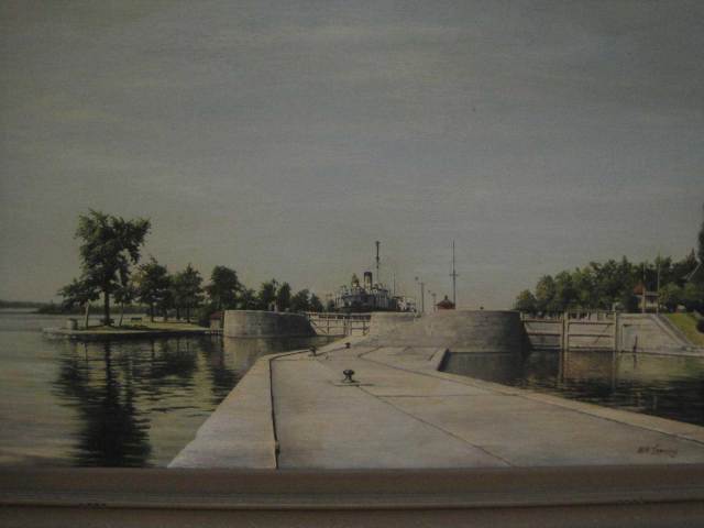
Here’s a photo of a wonderful painting I discovered hanging on the wall of one of the local church meeting rooms. No one could tell me who painted it. It shows how the approach pier sits at a lower level between the two locks. The pier originally had electric light posts along its top, many of which have simply been pushed over and remain there… now that I think about it, they are not present in the painting so they must have been installed later on. All the bollards remain intact.
The pier is normally accessed from the north wall of Lock 23. It can also be reached from the south side of the Rapide Plat Lock. It’s a bit downstream from both actual lock chambers.
The concrete cap at the top is a couple of feet thick. When you get to the top, you quickly discover that the current is very strong and there is precious little to hang on to if you’re waiting for other divers… you get to know where solid objects hang out!
Several years ago when Larry and I were just figuring out how to accurately hit the beach after leaving the pier (and the only route we knew at the time), we dragged out an “arrow” and fastened it to the Number 8 bollard (I think…) because we’d established that if we left that bollard and swam north, we’d usually hit the beach. Our dive friends found the still fastened arrow last summer and took a video of it for us! Special thanks to Bill and Rosie.
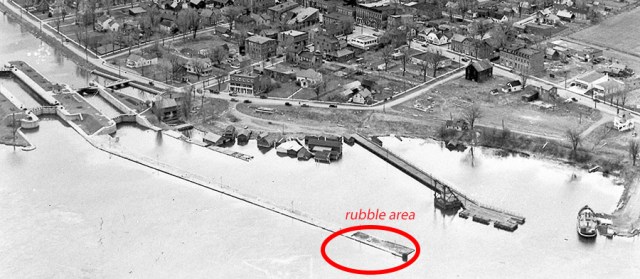
The pier is pretty long. It’s usually a speedy ride – depth 22-24 feet depending upon the river level – with bollards and downed light posts the only major items of note. You know you’re getting close to the end when you cross into a rubble-filled area.
At the end of the pier you’ll see a cluster of round pillars at the south corner – I imagine that they were positioned, like the curved ends of the locks themselves, to prevent damage to the pier by a ship that perhaps didn’t slow down and swerve quickly enough…
At any rate, you’re at the end of the road; the end wall is edged with ridged steel plating. Time to descend and move to the north in order to go home. There’s Larry at the bottom, waiting patiently as always.
At the base of the pier is river bottom. Plain ole’ river bottom. If you head due north from here and swim casually across (current is almost always extremely mild here), you will probably come up to the ferry dock (see this post) where you can do your safety stop and deploy your surface marker before heading in to the beach.
