Throughout this site, I’ve always said that Canada is north and the river flows east. I’ve also said that even as we use our compass to head north, the current carries us downstream as we swim, which means that we don’t arrive at the same point in the river that we started from.
Of late, however, some of us have examined this idea of direction rather closely, especially as it relates to getting to the beach at the end of our dive. We’ve discussed how we talk about heading north, but other than at the very beginning and very end of our swim, we head north-east. Therefore we’re not swimming as the diagram below suggests.
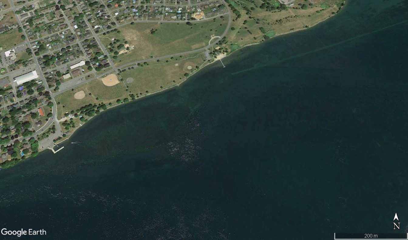
I know that in my introductory diagrams, North is tilted slightly because I chose to position the shoreline in a nice east-west direction. I was thinking that you had driven south to the river, parked, and were now looking out over the water which ran in a straight line across your field of vision. It’s reasonable to think this way as we motor underwater through the canal and locks, but as soon as we turn toward the exit, it becomes less straightforward.
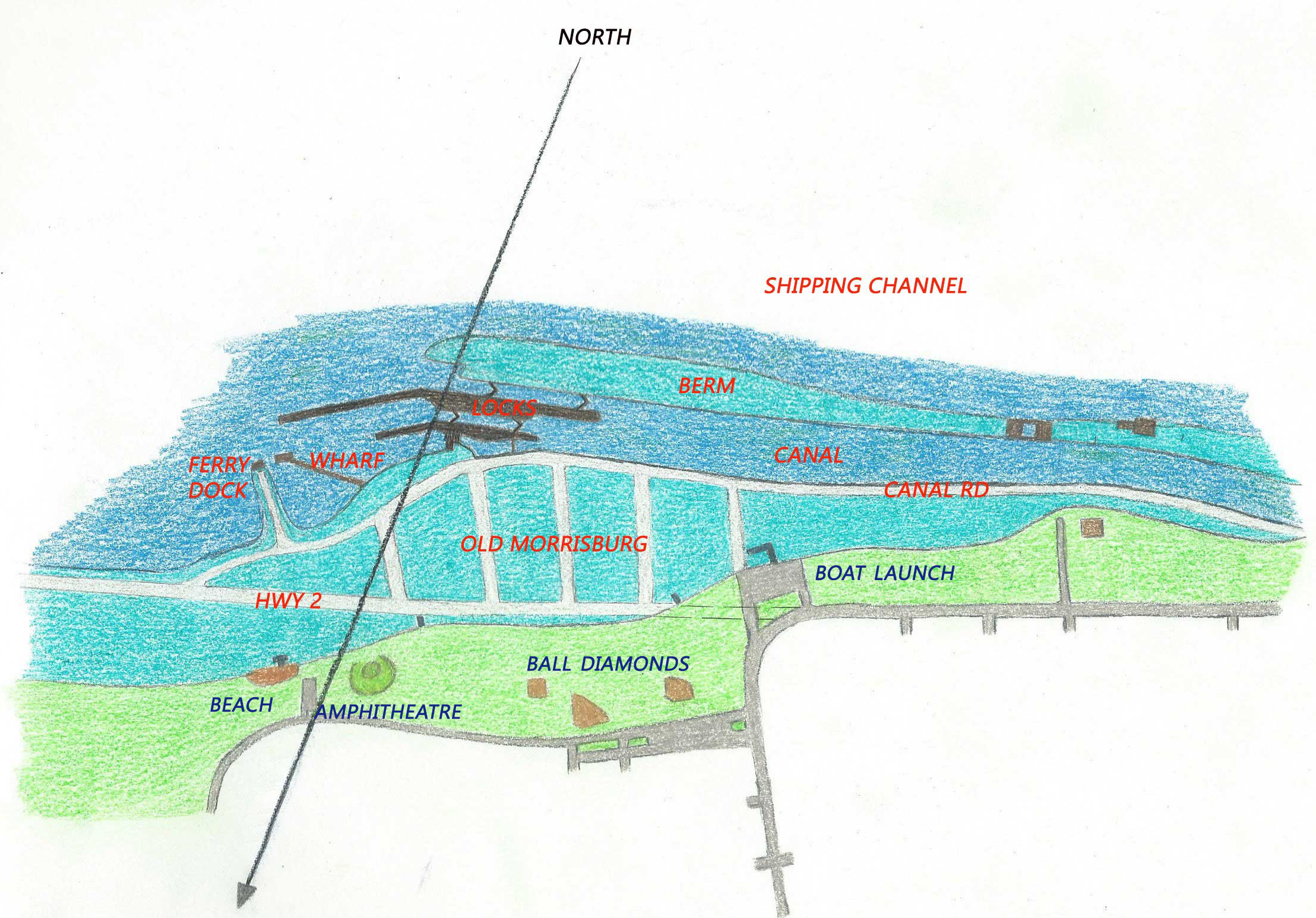
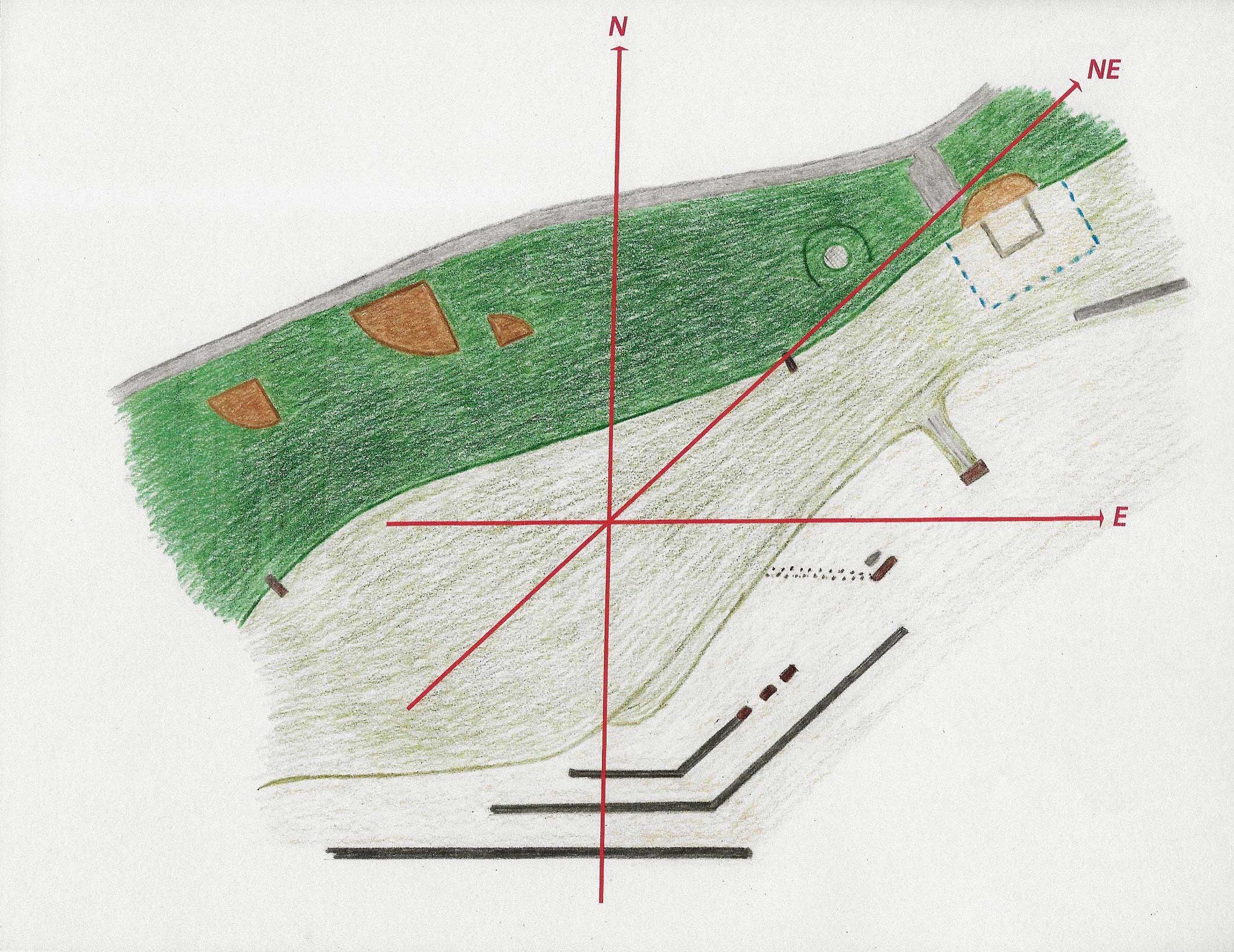
So… I’m about to add a new diagram, specifically for the exit swim – not to change the route at all, but purely to add information. This post and this post therefore do not change.
I’ve taken the exit area from above, flipped it top to bottom so that you’re now in the water and looking towards the land, then enlarged it and cropped it to include only the landmarks needed for the exit swim. I’ve placed the locks in their east-west position at the bottom, which means that the shoreline is now tilted, exactly as you see it on GoogleEarth.
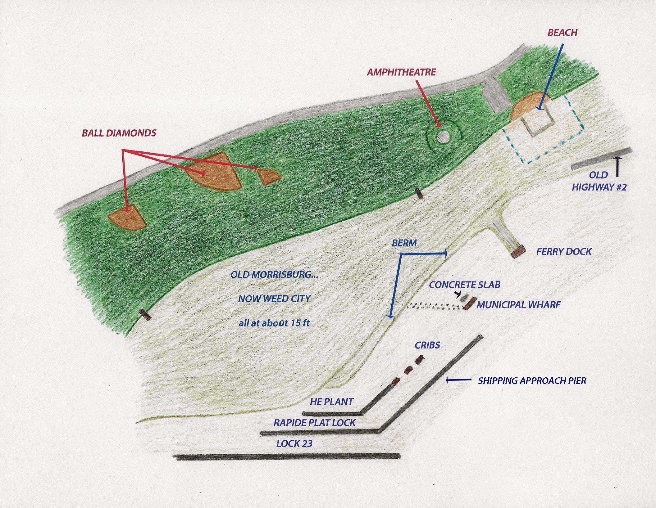
When I add the relevant compass points, you can see that:
- the locks run E
- the posts leading to the municipal wharf run E
- the approach pier and the hydroelectric plant tailrace wall run NE
- all the cribs, including the first three, the municipal wharf, and the ferry dock, run NE
- the small concrete slab north of the municipal wharf runs NE
- even the weedy shallows and the berm run NE, and the above-ground area is pretty close
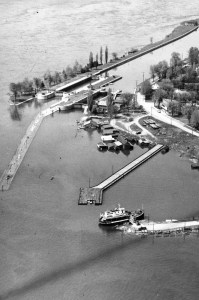
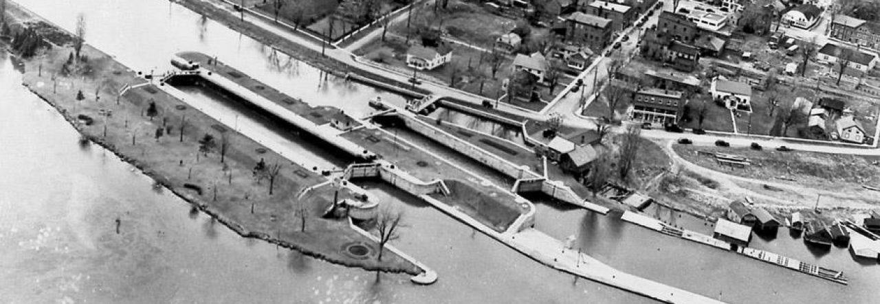
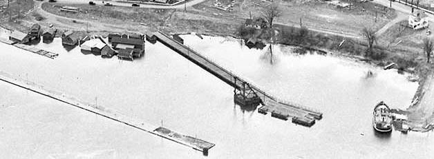
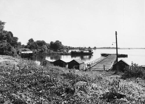
Here are two of the old aerial images of the area (both from stlawrencepiks.com):
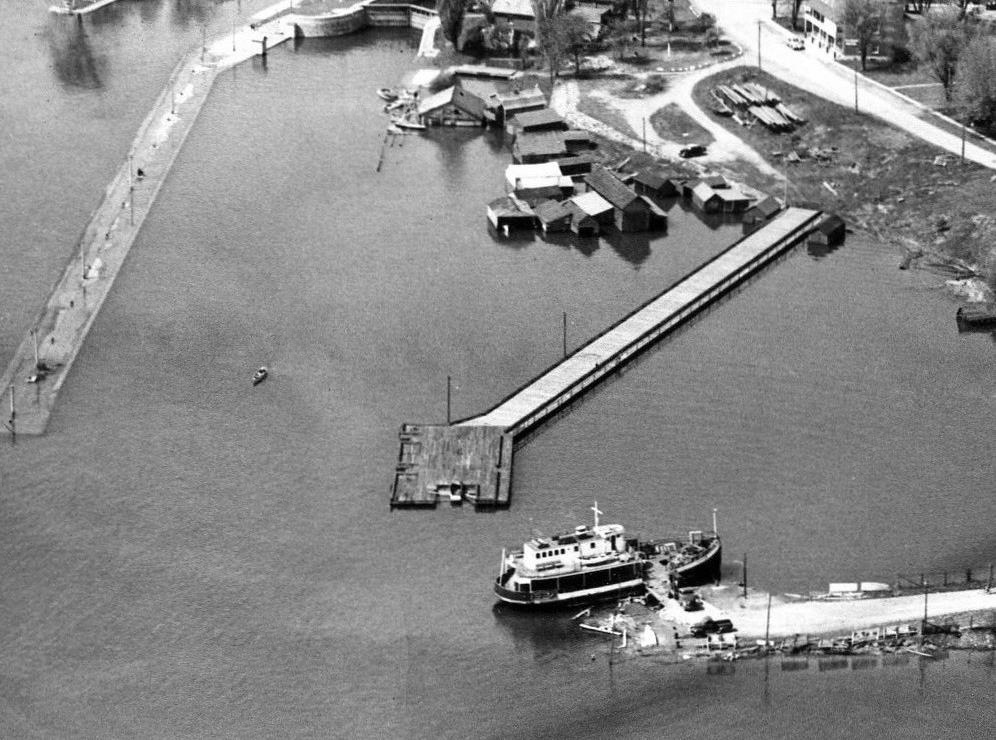
And, for interest’s sake, one of the municipal wharf with ferry dock to the left.
None of this information changes our exit route; it simply adds information.
When we leave the third crib and head NNE along a rope for a while, we’re putting some distance in before heading NE to the municipal wharf to allow for the slight current at the end of the locks.
When we follow the rope north from the municipal wharf to the concrete slab, we’re putting a bit more distance in before heading NE to the ferry dock because it is situated slightly more north, though still facing NE.
As a last comical note, as I was wrapping up this post, I thought, “Even the river seems to flow NE here, rather than E.” So I googled “St. Lawrence River”….
The St. Lawrence River (French: Fleuve Saint-Laurent, [flœv sɛ̃ loʁɑ̃]) is a large river in the middle latitudes of North America, flowing from Lake Ontario in a roughly northeasterly direction into the Gulf of St. Lawrence.
Wikipedia.org
Another piece of information about a site I know so well.
Sydney
