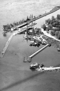
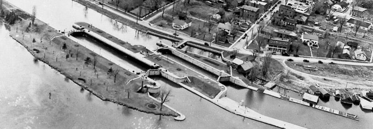
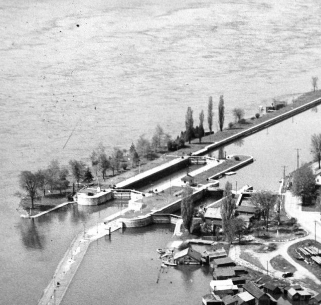
When Lock 23 was constructed in 1905, the berm abutting the south wall was developed into parkland for the community, and there are many local photos of events that took place there.

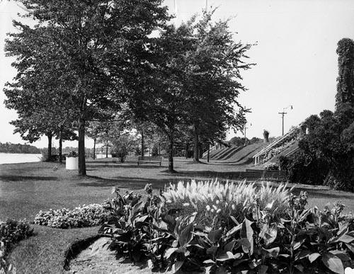

As part of the dive site today, at 15 (if you’re on the concrete pad of the lock) to 22 (if you’re in the lower park) feet, you skim above a lot of boulders and a lot of stumps. Because you’re right beside the main river channel, the current can be very quick. River depth also drops dramatically to the south if you leave the park. This is a major reason why a lot of advanced divers like to cruise here – simply to enjoy the ride! (It also makes me think about all the families who enjoyed activities in that park with its very steep drop-off into rapid current – remember that the whole point of the locks both in 1857 and 1905 was to bypass nasty river conditions.)
Thanks to fellow divers Frank and Iryna for sharing their Park videos from 2020!
Drifting in the Park
To get to the park, you simply ascend the great south wall of the canal. You can do this at any point along your initial approach journey.
The main park, however, is situated exactly alongside Lock 23. In fact its two staircases were extensions of the lock’s upstream and downstream gates. As you’re drifting, if you wait until you hit the sill or upstream gate and then climb, you’ll probably miss the first staircase.
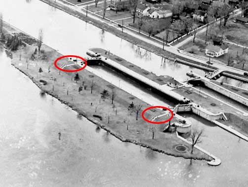
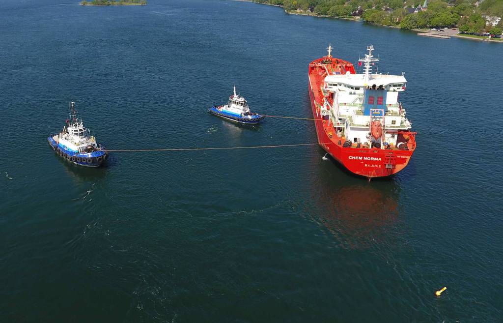
Both staircases were in good condition until the summer of 2018 when the tanker “Chem Norma” ran aground almost exactly between the two. The yellow buoy you see in both photos is anchored at the end of the park, although in deeper water. It wasn’t the freighter itself that caused much damage (it just got wedged on the berm)… but the terrific water churning as the tugs trying to free it jostled an awful lot of rock and mud. The wall itself was unaffected.

Today both sets of stairs are broken and shifted but still easily visible. Here’s Frank and Iryna coasting past the second set.
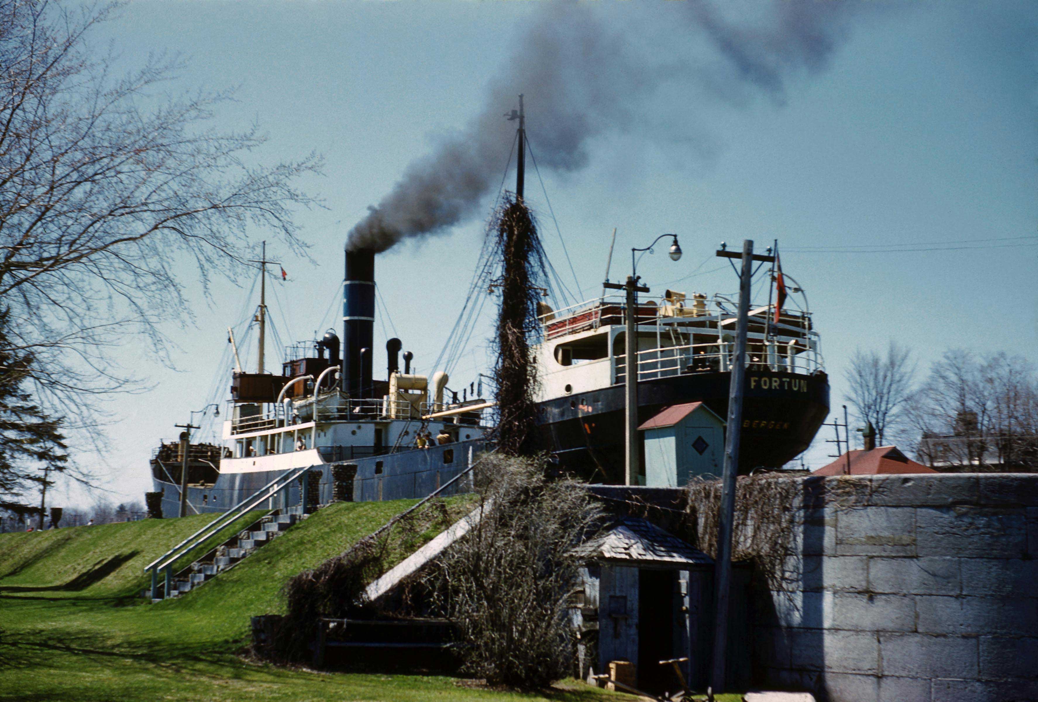
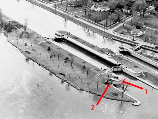
Once you’re past the second set of stairs, you’re nearing the end of the upper park and will quickly come to the curved wall that marks the end of the lock where the water level is now that of the downstream river (1). Note the angled end of the lock wall (2). Nestled into the corner was once a small shed which appears to have housed tools for park maintenance. The high position of the freighter demonstrates the lock level raised and the ship ready to exit.

Here are Frank and Iryna in that corner space.
At this point you can skim across the park area to its end or you can drop over the edge into the lock and examine the wooden foundations of this area. I have shown all of this in this post on Lock 23 itself. As I mention there, you are now at the end of the park and beyond the end of Lock 23. To get home you must turn north.
If you want to examine the St. Lawrence River downstream, I suppose you could keep drifting… but you’d get into the shipping channel and further and further away from Canada…. Larry and 2 friends did this by accident several years ago. They ran out of air, had to drop their weights, and had to be picked up by a passing motorboat. Ahem.
